
Fresh from my success with the Inca Trek, I am now convinced that I am a hiker (cue eye-roll from Fausto). I tried to convince the hubby that it’s better to spend the weekend trekking up the mountain than sitting on our butt watching TV. I am not sure he is entirely convinced about the fresh air and exercise, but nevertheless he was game and off we went.
About an hour and a half away on Metro North, right outside of the town of Cold Spring you’ll find many trail heads that take you to the top of the nearby peaks with beautiful vantage points over the valley below. We started our 7-8 mile hike up to the peak of Mount Taurus (more commonly known as Bull Hill) and looped around to the other side of the mountain before descending back to the starting point.
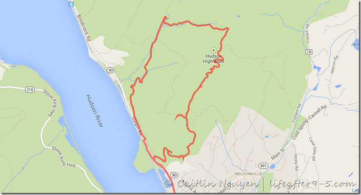
map of our hike around Bull Hill
There are several ways for you to summit Bull Hill, you can ascend on the less steep blue Cornish trail, go with the white Washburn trail which is shorter distance but higher difficulty, or you can be like us and choose to go up the Washburn trail and descend on the Cornish trail and get the best of both worlds. As stated earlier, the whole loop was about 7.5 miles long (we used Google Tracks to track our hike and create the map above) and it took about 5.5 hours to complete including rest stops. The following are highlights and photos of our hike:

1. The trail starts from the parking lot off of Route 9D, across from Little Stony Point. From here you can check out the trail map. Almost right at the start of the trail, you’ll see the clearly marked junction for the different trails. To the left is the blue Cornish trail and to the right is the white Washburn trail.

White marker for Washburn trail
2. Continuing on the trail you’ll pass through a path covered in high grass; beware of ticks in this area. I had to ask Fausto to check several times to make sure I didn’t get any on me! Don’t worry, the path will open up in a few minutes.

Landscape near the quarry
3. Winding your way through the forest for about half a mile, you’ll approach an opening that leads to an abandoned quarry. The quarry is just a pile of rocks long forgotten, but the plain next to it is very picturesque with the morning light filtering through the small trees. The whole landscape is reminiscent of an African savanna and made me think there is a lion lurking in the grass.

Washburn trail
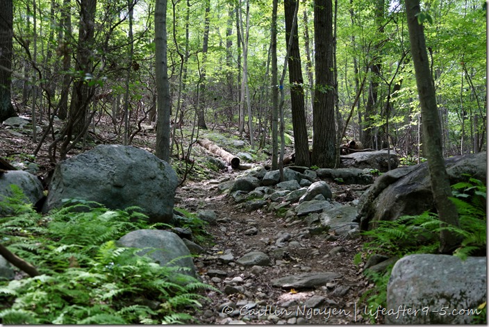
4. The trail here is a little hard to find, you’ll need to double back to the path right before the opening of the quarry and take a sharp right. Continue climbing up on the white trail until you get to the white/yellow junction.
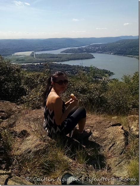
Picnic at the platform overlooking the Hudson River
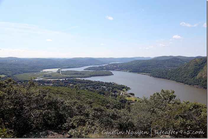
5. At this junction, you want to deviate from the white trail and follow the yellow markers to the rocky platform that has a perfect view of the Hudson River to the north. Off in the distance, you will also be able to see the prestigious Westpoint Academy. This is where we chose to break for lunch because it’s a little bit off the beaten path and relatively secluded.
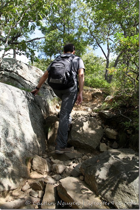
Scrambling up rocky trails
6. Retrace your way back to the white/yellow crossroad and continue to follow the white markers to the top. At this point, the incline is higher and you have to scramble over some rocky steps. The summit is about 15 minutes away.

View from the top of Bull Hill

7. Finally after about 2 hours of climbing, we reached the top and were rewarded with the panoramic view of the valley below. It’s a good place to sit back and enjoy nature. On a clear day, if you squint your eyes, you’ll be able to see the New York City skyline in the distance.


8. After you appreciate the view, you can choose to go back the way you came from or continue on with the white trail. Pass the lookout point the trail starts to descend following switchback roads down the mountain. Continue on until you get to the blue/green junction where you want to take the left onto the blue Notch trail.

Abandoned Cornish dairy farm

9. Follow the rocky path down passed the eroded section of the woods. You’ll see a stream that has dried up due to the lack of precipitation this summer. Once you get to the blue/red junction, take the left fork with red markers onto the Brook Trail. Slightly off the path, there is a stone ruin that used to be a dairy farm.


Cornish estate

Stacked fireplaces in abandoned estate
10. Continue on the red trail along the Breakneck Brook (pass the red/yellow junction) until you get to a fork in the road. Take the left path onto an old carriage road that leads to an abandoned estate formerly owned by Edward Cornish. The dilapidated buildings are overgrown and overtaken by nature. Here and there you can still see traces of the old grandeur, like the stacked fireplaces in relatively good condition.

Walking along stone cistern
11. Continue on the blue marked trail past the stone cistern heading downhill until you intersect with route 9D.

Pingback: Day Tripping to Cold Spring | life after 9to5
Beautiful scenery photos that you took!
LikeLike
Thank you!
LikeLike
Move back to CT, and you can go hiking with Maggie’s husband and John. =)
LikeLike
Or they can come to New York.. There are a lot of places to hike around here. Where do they go in Connecticut?
LikeLike